Residential Supply Layer & Forecasts – City of Whittlesea
GIS‑Enabled Residential Supply Layer & Forecasts for Whittlesea
At a glance
Client: City of Whittlesea Council
Scope: Residential Supply in Established areas—site‑level capacity, timeframes and annotations
Horizon: 2026–2051
Deliverables: Council‑ready RSL for internal use and scenario testing.
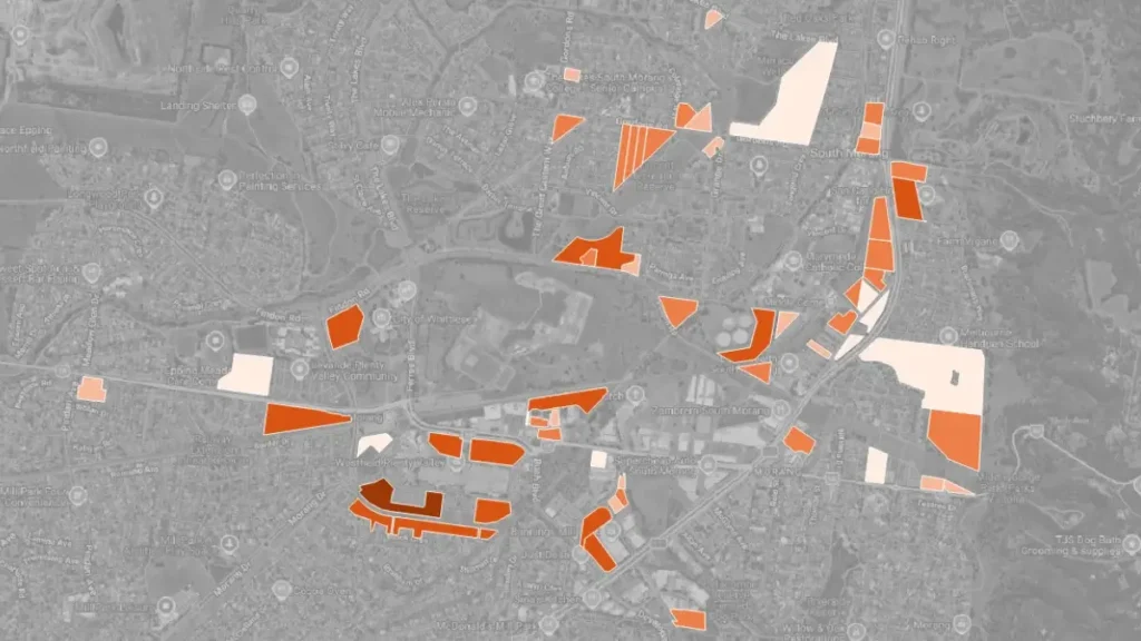
Objective
Demographic Solutions delivered an up‑to‑date, GIS‑enabled Residential Supply Layer (RSL) for Whittlesea’s established areas—validating development timeframes, estimating dwelling capacity and adding clear site‑level annotations for every identified residential parcel. The data was to be used to underpin LGA wide population forecasts.
What we did
Verified sites & timeframes: Reviewed and validated residential site capacities, status and development timeframes using multiple data sources, including planning data, development activity records and Council insights through workshops.
Refined activity centre assumptions: Assessed current development patterns and behaviours to revise capacity assumptions for unplanned but zoned areas, including lands in key activity centres.
Surfaced long‑range capacity: Identified longer‑term development opportunities beyond 2041 to support strategic growth planning.
Up-to-date GIS dataset: Integrated all evidence into a standardised, GIS‑enabled RSL with clear annotations and data management standards.
Outcome & Impact
Delivered a robust evidence‑based GIS layer that clarified development capacity, sequencing and long‑term growth potential across Whittlesea’s established areas. The assessment also highlighted strategic opportunities beyond 2041, enabling Council to more effectively plan for future growth, infrastructure provision and policy development.